

You can find on this page the map of Berlin ferry. Berlin ferry is a transit system serving the city of Berlin (Germany) with the subway, the urban, suburban & commuter train, the tram or the bus. The ferry network has 6 lines.
Berlin ferries exist since 1896 and are operated by the BVG (Berliner Verkehrsbetriebe).
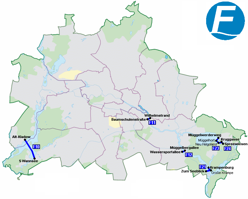
Its network includes the following 6 lines:
• Line F10: S Wannsee ↔ Alt-Kladow
• Line F11: Wilhelmstrand ↔ Baumschulenstraße
• Line F12: Müggelbergallee ↔ Wassersportallee
• Line F21: Krampenburg ↔ Große Krampe ↔ Zum Seeblick
• Line F23: Müggelwerderweg ↔ Müggelhort ↔ Neu Helgoland ↔ Kruggasse
• Line F24: Spreewiesen ↔ Kruggasse


