

You can find on this page the map of Berlin subway. Berlin u bahn, subway, tube or underground is a transit system serving the city of Berlin (Germany) with the urban, suburban & commuter train, the tram, the bus or the ferry. The subway network has 10 lines and 173 stations forming a rail network of 90 miles (146 km).
Berlin subways which transport 457.5 mllion passengers per year, exist since 1902 and are operated by the BVG (Berliner Verkehrsbetriebe).
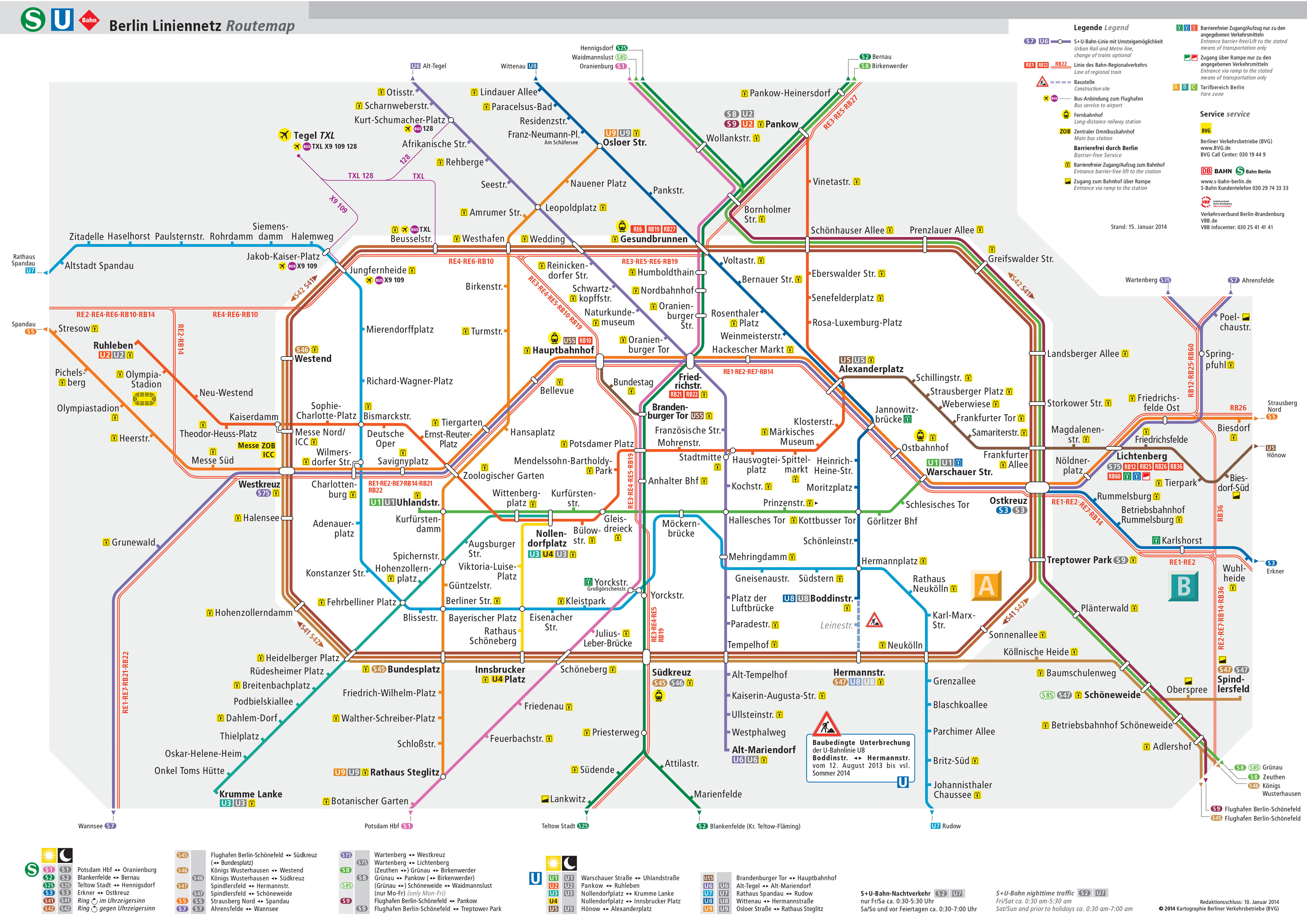
Its network includes the following 10 lines:
• Line U1: Uhlandstraße ↔ Warschauer Straße
• Line U2: Pankow ↔ Ruhleben
• Line U3: Nollendorfplatz ↔ Krumme Lanke
• Line U4: Nollendorfplatz ↔ Innsbrucker Platz
• Line U5: Alexanderplatz ↔ Hönow
• Line U55: Berlin Hauptbahnhof ↔ Brandenburger Tor
• Line U6: Alt-Tegel ↔ Alt-Mariendorf
• Line U7: Rathaus Spandau ↔ Rudow
• Line U8: Wittenau ↔ Hermannstraße
• Line U9: Rathaus Steglitz ↔ Osloer Straße


